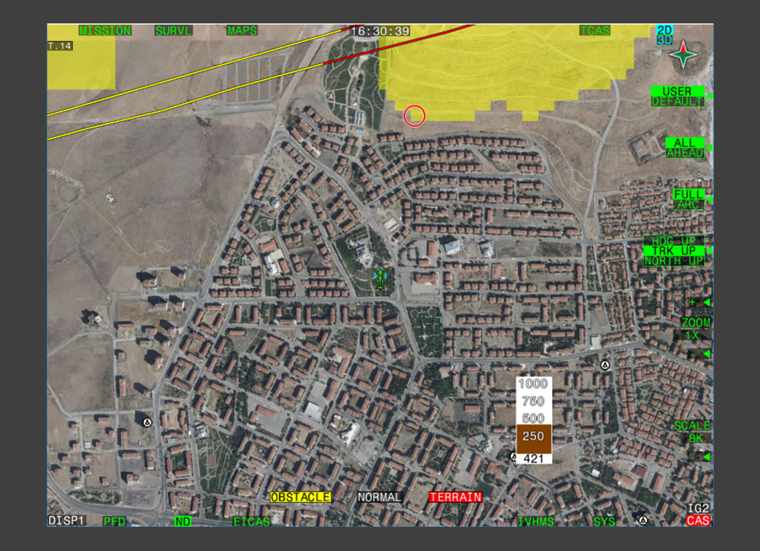
Helicopter Terrain Awareness and Warning System Utility Helicopter
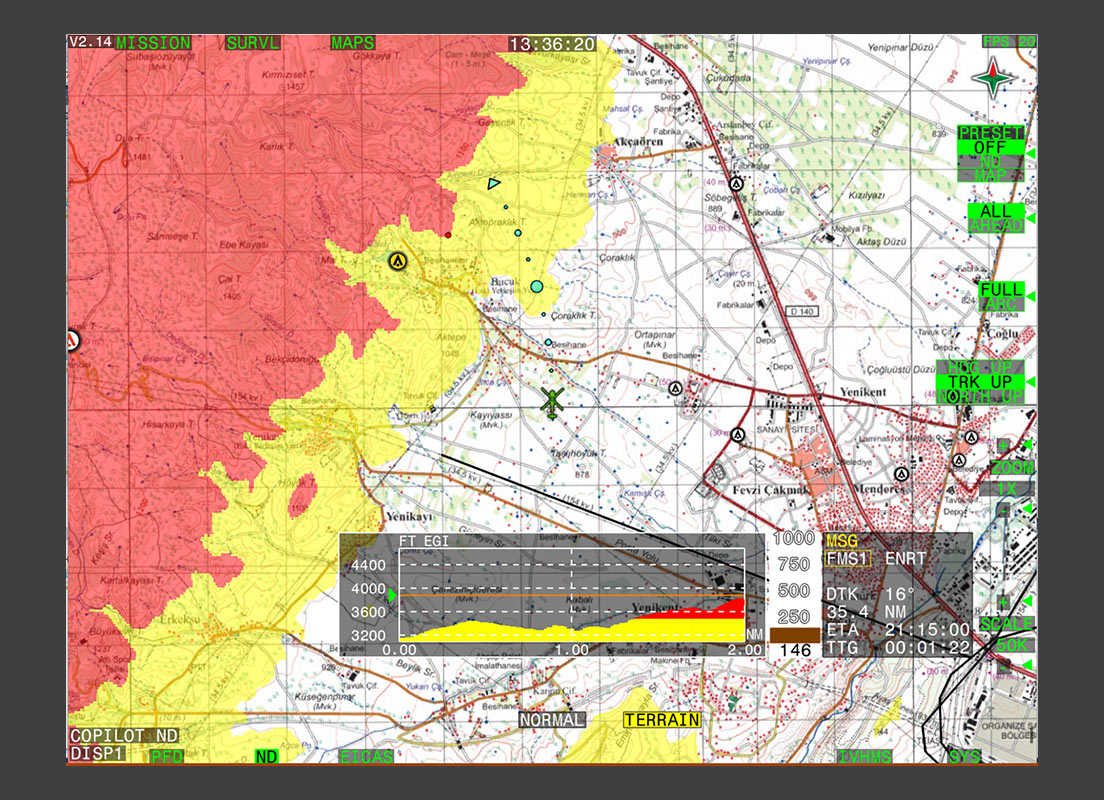
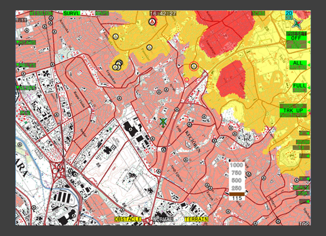
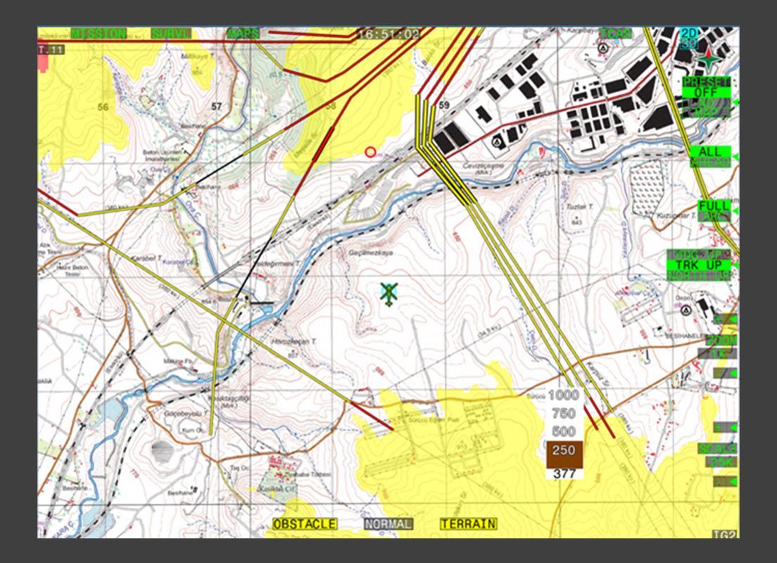
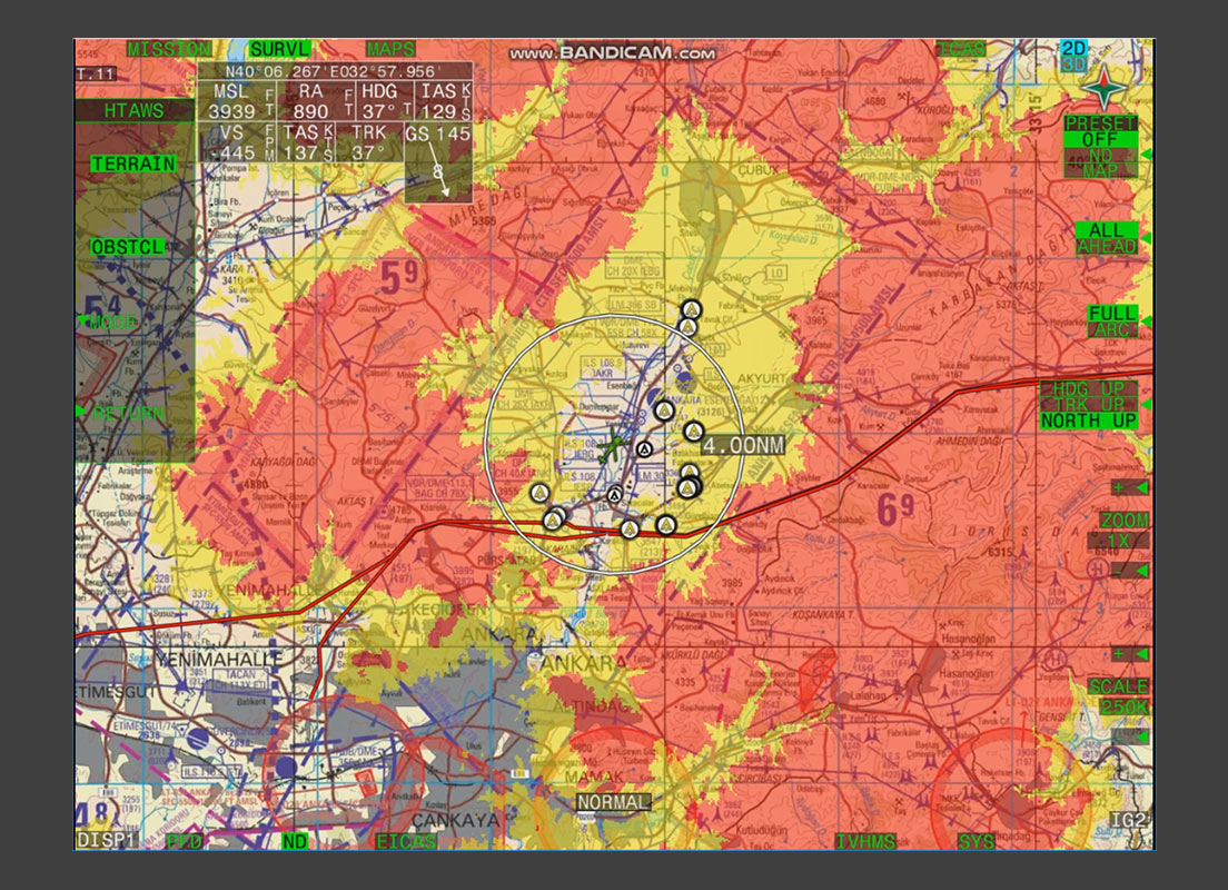
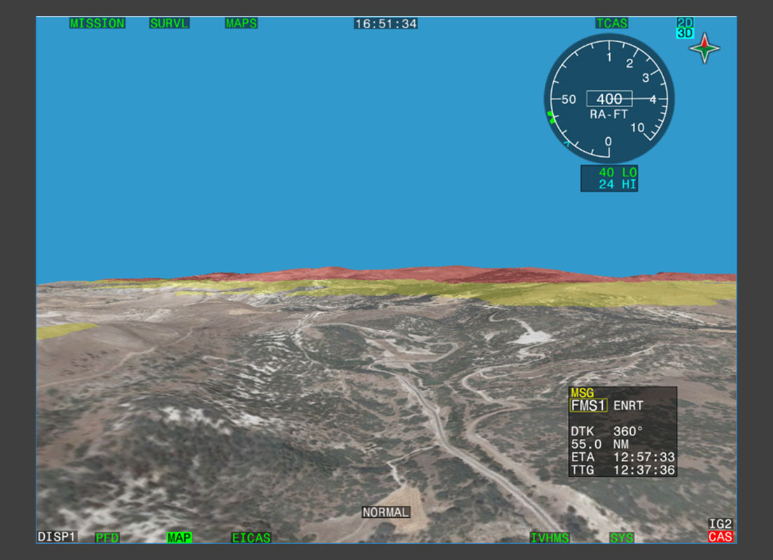
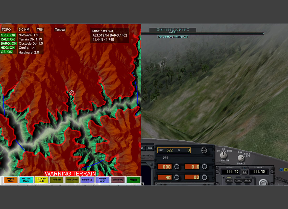
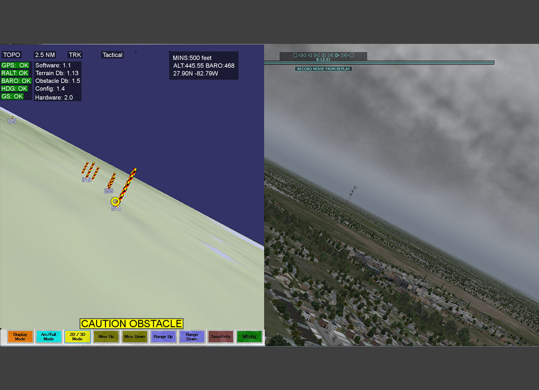
HTAWS is primarily intended to reduce the risk of a Controlled Flight into Terrain (CFIT) accident for rotorcraft by providing enhanced situational awareness of the surrounding terrain and obstacles during the cruise phase of flight in Visual Meteorological Conditions (VMC) and Instrument Meteorological Conditions (IMC) when conducting Instrument Flight Rules (IFR). HTAWS receives inputs such as position, flight data, terrain and obstacle information and generates visual information as well as acoustic and visual warnings. The HTAWS software can be integrated into any flight computer and any display system via a clearly defined, ARINC 653-compliant interface.
Standards
- The HTAWS solution fully complies with the RTCA DO-309 standard
- DO-178B compliant processes
- ARINC 653 compliant software interface
Advantages
- Compliance with RTCA DO-309
- 6 warnings/cautions in addition to the 4 DO-309 warnings/cautions
- Can be integrated into ARINC 653 compliant environments
- Can be certified to DO-178B Safety Level C.